Subject: World
Period: 1787 (circa)
Publication: Nieuwe Natuur-Geschieden Handelkundige Zak-En Reis-Atlas
Color: Hand Color
Size:
11.4 x 7.1 inches
29 x 18 cm
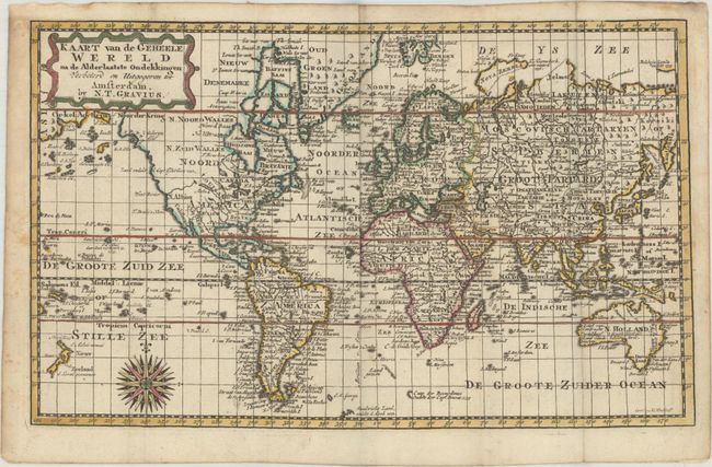
Uncommon small world map on Mercator's projection. New Zealand is fully delineated and the eastern coast of Australia is beginning to take shape based on Captain James Cook's second voyage, although Tasmania is still connected to Australia. The location of Cook's death in the Sandwich Islands (Hawaii) in 1779 during his third voyage is noted. The new United States is named "Vereen State" and extends west to the Mississippi River. A River of the West (West Rivier) extends from the Pacific well into the middle of North America. Despite knowledge of Cook's third voyage, Alaska has not yet taken shape. Engraved by H. Klockhoff. This map appeared in Gerrit Brender a Brandis' Nieuwe Natuur-Geschieden Handelkundige Zak-En Reis-Atlas, which was published by Nicholaes Theodorus Gravius. The atlas included many maps engraved by Jacob Keizer and published in pocket atlases by Jan de Lat, some of which were updated with new geographical information and with Gravius' imprint replacing that of Keizer and De Lat.
References:
Condition: B+
A sharp impression with contemporary outline color in the map and later color in the cartouche, issued folding with a small stain in Turkey and marginal foxing and soiling.