Subject: Eastern United States
Period: 1812 (dated)
Publication:
Color: Hand Color
Size:
27.9 x 23.9 inches
70.9 x 60.7 cm
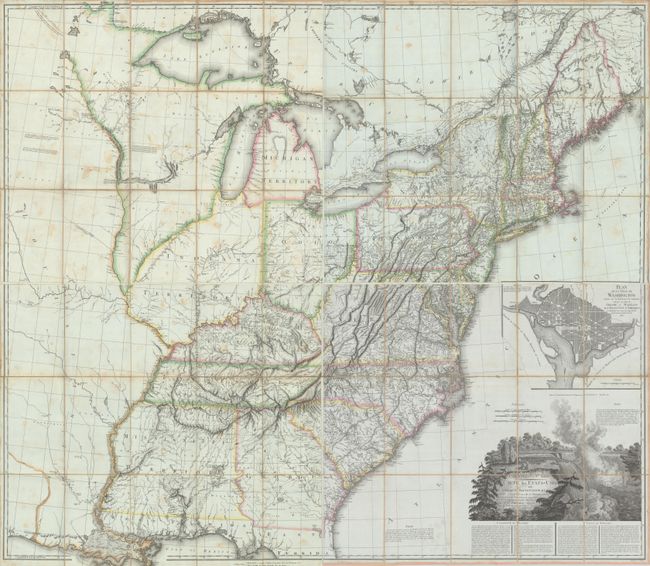
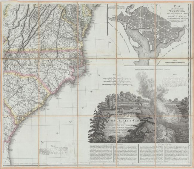
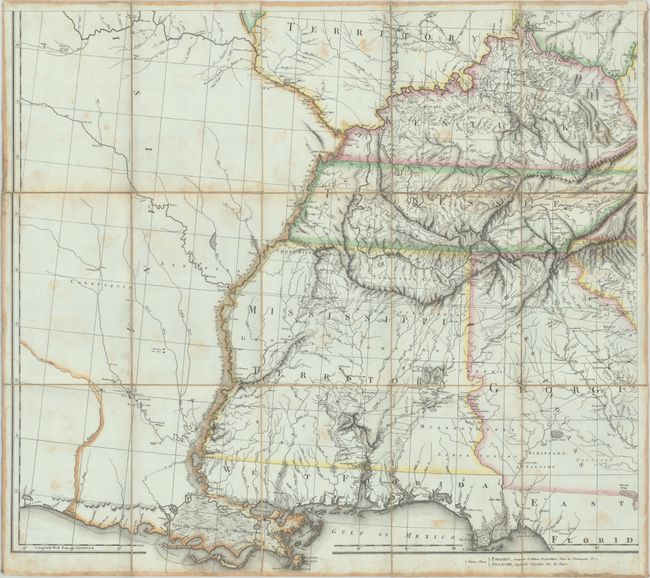
This is a French edition of Aaron Arrowsmith Sr.'s influential map of the United States, which was first published in 1796 and is notable for being used by Lewis and Clark to plan their famous expedition. Tardieu's map of the United States is one of the rarest and most interesting large format maps of the period. Tardieu updated and improved his map based on new sources, which are listed in a note above the title, and added an inset plan of Washington, DC based on Ellicott's plan of the new American capital city. The beautifully engraved title cartouche features Niagara Falls, which was copied from Arrowsmith's map, and is accompanied by a fascinating description of the Falls in both French and English.
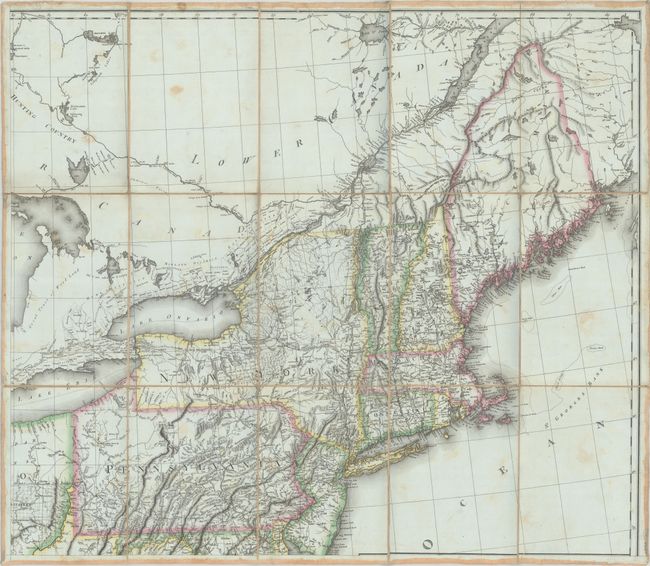
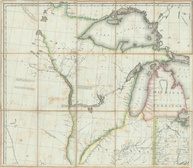
This 1812 third edition of Tardieu’s map was published 10 years after his first edition, and reflects the rapid development taking place in the trans-Appalachian west. The region to the north of the Ohio River, which was previously unorganized, is now the state of Ohio, Michigan Territory, and Indiana Territory. In the south, a large Mississippi Territory now appears from an oversized Georgia. Florida is still divided between East and West, and beyond the Mississippi River is a large Louisiana mostly void of detail. Outside of political boundaries, the map is filled with numerous notations describing the land and rivers, the location of Indian tribes, paths, rivers, and more. Tardieu translated some of Arrowsmith's original notations into French, however left many notations and place names in English. He also added new notations in both English and French based on his sources. A few of the new English notations include regions in Canada that are noted as "hunting country," "great tract of wood land" and "immense forests." Tardieu also used manuscript maps to add extensive detail above Lake Erie, Lake Ontario and along the St. Lawrence River. Tardieu was largely successful in retaining the important cartographic details from Arrowsmith's map yet adding new information and improving upon the original edition.
Tardieu made at least 5 editions of this map, including 1802, 1808, 1812 (this edition), 1818 and 1820. Each of the four sheets is dissected into 9 sections and mounted on contemporary linen, as issued.
References:
Condition: B+
Contemporary outline color with minor soiling and some staining that is more prevalent on the two western sheets. Dissected and backed with contemporary linen. The first image is a composite image - the map is in 4 separate sheets.