Catalog Archive
Auction 196, Lot 588

"Tabula Geographica Terrae Sanctae Auctore I. Bonfrerio Societat. Jesu", Halma, Francois
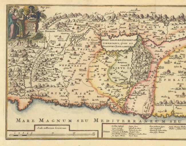
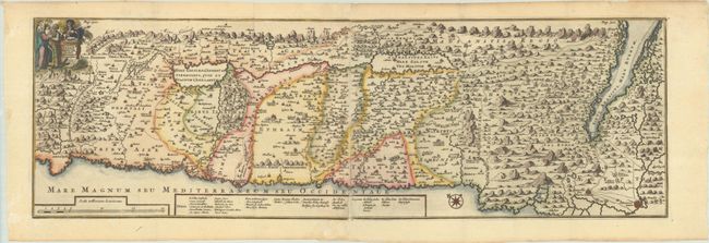
Subject: Holy Land

Period: 1709 (circa)

Publication:

Color: Hand Color

Size:
26.3 x 8.3 inches
66.8 x 21.1 cm
Download High Resolution Image
(or just click on image to launch the Zoom viewer)

This uncommon, panoramic view of Israel was created by the Flemish theologian, Jacques Bonfrere. The map is oriented with north at top left and is divided into the twelve tribes with a key at bottom. The Wandering of the Children of Israel is shown with the 42 encampments. The title cartouche includes Moses, Aaron and a Roman soldier. Two sheets joined, as issued. Published by Halma.

References: Poortman & Augusteijn #167.

Condition: A

A sharp impression, issued folding with marginal soiling and toning, and a few small pieces of tape along the left edge of the sheet.

Estimate: $200 - $230

Sold for: $150

Closed on 2/7/2024

Archived