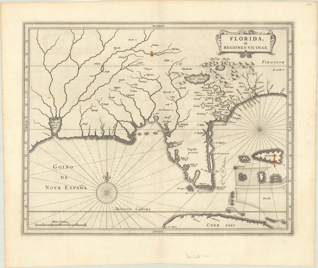
Subject: Colonial Southern United States
Period: 1640 (circa)
Publication: Nieuwe Wereldt ofte Beschrijvinghe van West-Indien…
Color: Black & White
Size:
14.1 x 11.1 inches
35.8 x 28.2 cm
This is one of three maps of North America that was included in De Laet's important work on the Americas. It greatly influenced the subsequent work of Blaeu, Jansson and Sanson. It was most likely engraved by Hessel Gerritsz, who drew on the cartography of Jacques le Moyne, as interpreted by Claesz. The Florida Peninsula is here named Tegesta provinc, the name of an Indian tribe that lived on the southwest coast, while the larger region is called Florida. Much of the other nomenclature was drawn from the Chaves/Ortelius map of 1584 with the notable additional place names of St. Augustine and Tampa Bay. Near the western border is the Bahia del Spiritu Santo, which is fed by several large rivers.
References: Burden #232; Cumming (SE) #34.
Condition: B+
A dark impression on a bright sheet with a coat of arms watermark, faint offsetting, two small stains in the image, and minor toning along the edges of the sheet. Without the stains, this example would be considered A+.