Subject: New England United States
Period: 1823 (dated)
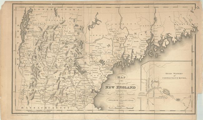
Publication: Travels in New England and New York
Color: Black & White
Size:
14 x 8.3 inches
35.6 x 21.1 cm
This uncommon map covers the region from the northern boundary of Massachusetts to Maine, Vermont and New Hampshire with good detail of roads, settlements and topography. A small inset at bottom shows the "Head Waters of Connecticut River." The map is remarkable for its the use of Yale College as its Prime Meridian - a unique configuration to our knowledge. Published in Timothy Dwight's Travels in New England and New York. Dwight was a minister, theologian, educator, and author. He served as the eighth president of Yale College. Compiled by George Gillet and engraved by W. Wright in London.
References: Howes #D-612; Phillips (Maps) p. 247.
Condition: B+
Issued folding with minor toning and offsetting. A couple of short fold separations along the edges have been closed on verso with archival tape. There is a small binding trim at bottom right.