Subject: Western Hemisphere - America
Period: 1950 (circa)
Publication:
Color: Printed Color
Size:
17.6 x 23.5 inches
44.7 x 59.7 cm
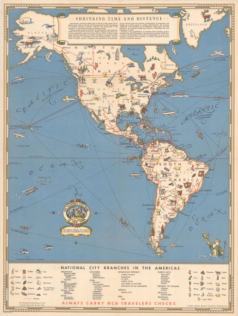
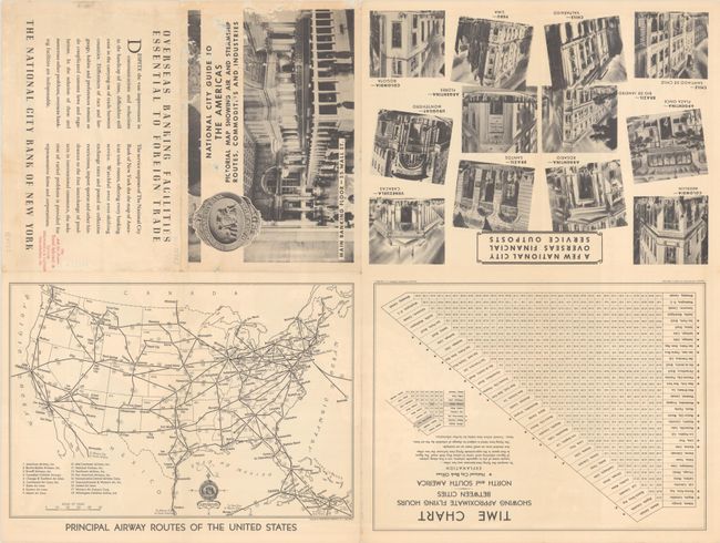
This scarce and attractive pictorial map was a promotional item for the National City Bank of New York (now Citibank). The map presents the National City Bank as a pioneer in the shift to a global economy, with a table at bottom listing the bank's 42 branches in South America and the Caribbean. The natural resources of the Americas are represented graphically, and air routes are depicted in red. A compass rose at bottom incorporates the bank's logo, with the slogan "The branch around the corner can serve you around the world." On verso is another map, Principal Airway Routes of the United States (11.5 x 7.9"), and a time chart showing flying hours between cities in the Americas. Published by the Hagstrom Company, Inc. Self-folding (9.0 x 6.0").
References: Rumsey #12166.
Condition: B+
A colorful example, issued folding, with a few tiny splits at the fold junctions and a couple of small abrasions on verso resulting in minor loss in the map image.