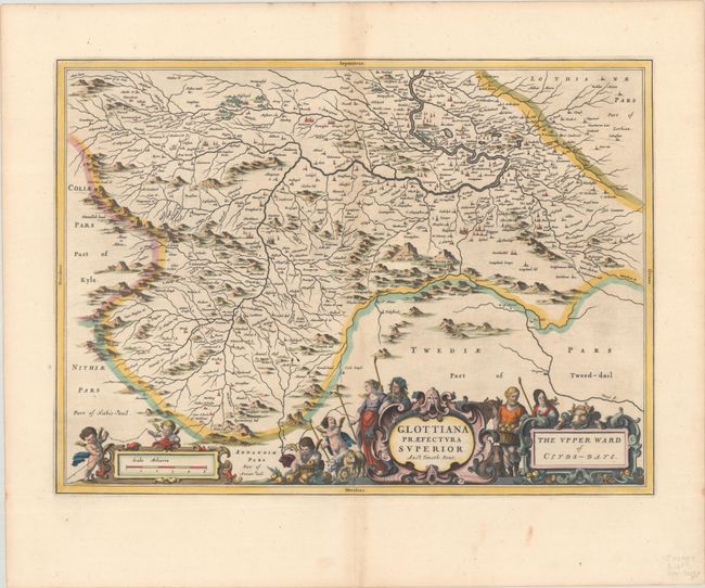
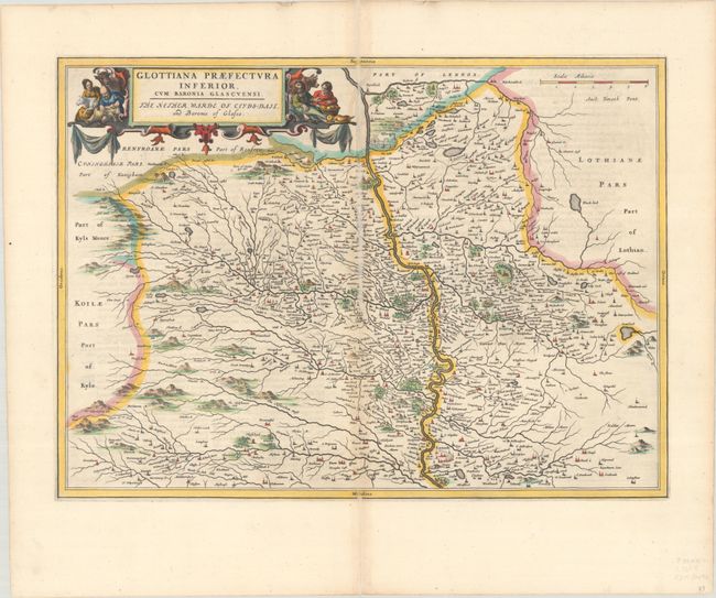
Subject: Southern Scotland
Period: 1654 (circa)
Publication:
Color: Hand Color
Size:
21.1 x 15.4 inches
53.6 x 39.1 cm
This pair of maps depict the former Clydesdale district, now part of South Lanarkshire. The northern sheet extends from Glasgow to Lanark with the Clyde River prominently depicted. The maps are filled with hundreds of tiny towns and show the extensive river system in the region. Each map stands on its own with full borders and a superb title cartouche. The southern sheet is credited to Timothy Pont.
Publication of Bleau’s atlas of Scotland (Atlas Novus, Volume V) in 1654 was a landmark publication in cartographic history. Most of the maps were based on the surveys of Timothy Pont, which had been done half a century earlier. The publication took over seven decades to bring to publication; it was delayed by wars, copyright restrictions, and only intermittent official support. The maps are scarce today due to the relatively short publication history of the atlas.
References: Van der Krogt (Vol. II) #5843:2
Condition: B+
Both sheets have crisp impressions on bright sheets with light toning along the centerfold and minor offsetting. The northern sheet has an archivally repaired centerfold separation with part of the archival tissue on recto, partially obscuring a small amount of the image. The southern sheet has a short centerfold separation at bottom.