Subject: World
Period: 1748 (dated)
Publication:
Color: Hand Color
Size:
27.8 x 19.9 inches
70.6 x 50.5 cm
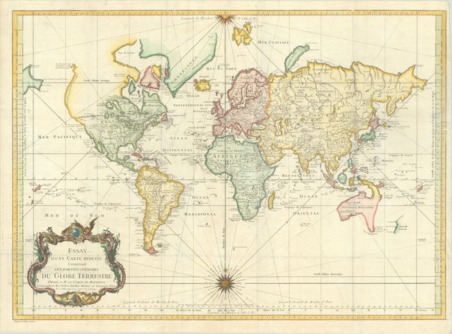
Early issue of this fine large world chart on Mercator's projection decorated with a large title cartouche and two compass roses. North America is shown with a very pronounced River of the West connecting through a series of rivers and lakes from Lake Superior to the Pacific - representing the elusive Northwest Passage. The Russian discoveries in the North Pacific are not yet shown, although there is a note about the voyages of 1743. Australia is labeled Nouvelle Hollande with Terre de Diemen and Nouv. Guinee both linked to the mainland by conjectural coastlines. New Zealand is only partially formed, and there are numerous islands in the Pacific.
References:
Condition: B+
Issued folding on a bright sheet with the watermark of a Maltese cross encircled in rosary beads and a hint of offsetting. There are archival repairs to some separations along the folds and to 3 tears at right that extend between 1"-5" into the image.