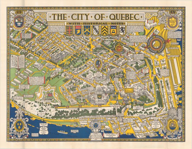
Subject: Quebec City, Canada
Period: 1932 (dated)
Publication:
Color: Printed Color
Size:
33.3 x 25.3 inches
84.6 x 64.3 cm
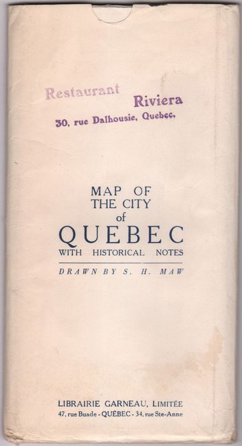
This eye-catching pictorial map of Quebec City is in the style of MacDonald Gill, best known for his humorous London Underground map. The densely filled map displays parks, buildings, named streets, and historic notations. The crests of Wolfe, Frontenac, Champlain, and Cartier are tucked into the sheet corners and a large compass rose orients north to the right. A note in the bottom right corner states that "this map commenced in 1926- completed in 1932-... Dimensions & proportions must not be taken seriously. It being the intention of the author only to amuse & instruct." Created by Samuel Herbert Maw, an English artist who created several pictorial maps while living in Canada. This example is accompanied by the original envelope in which it was issued with the title and artist printed on front.
References:
Condition: A
A crisp, bright example, issued folding, with some very faint color offsetting in the blank margins. The envelope is lightly soiled with a faint dampstain and the stamp of "Restaurant Riviera 30, rue Dalhousie, Quebec."