Subject: North America
Period: 1856 (circa)
Publication: Morse's General Atlas of the World...
Color: Hand Color
Size:
11.9 x 15.1 inches
30.2 x 38.4 cm
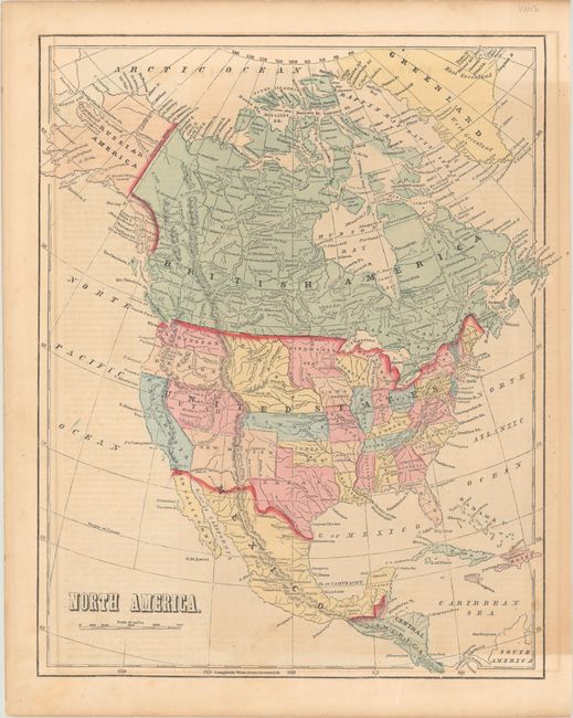
Issued in Morse's General Atlas of the World, this map shows evolving territorial configurations in the west. Utah and New Mexico territories are in their largest extent, and both Washington and Oregon territories extend to the Continental Divide. Kansas and Nebraska territories extend from the Missouri River to the Rocky Mountains, and Minnesota Territory includes the eastern portion of the Dakotas. The boundary with Mexico reflects the Gadsden Purchase. The map identifies state/territorial capitals along with topography and the river systems.
References: Phillips (Atlases) #817-5.
Condition: B+
Contemporary color with some uneven toning at right and light offsetting.