Subject: North America
Period: 1795-98 (circa)
Publication:
Color: Hand Color
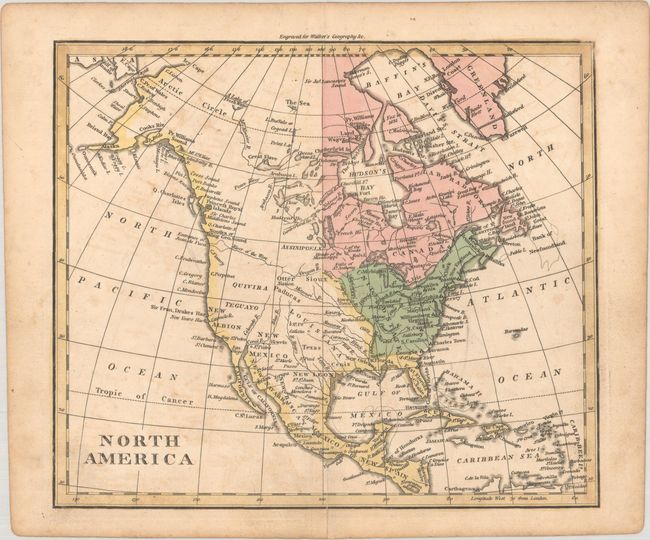
A. North America, by John Walker, from Elements of Geography, circa 1795 (8.6 x 7.3"). This attractive map of North America shows the United States confined to east of the Mississippi River with East & West Florida to its south. Louisiana stretches from the Mississippi River west to the Rocky Mountains, and Spain is in control of the western United States. A River of the West is connected to a series of tributaries, suggesting a possible Northwest Passage. To the north, Alaska is taking shape with a few islands shown at the end of the Aleutian Peninsula. Condition: There is light offsetting and toning.
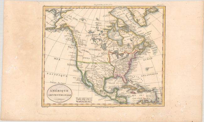
B. Amerique Septentrionale, by Alexandre Blondeau, from Atlas Universel pour la Geographie de Guthrie, circa 1798 (8.8 x 7.3"). This small map of North America is an interesting document of a continent still in the process of being explored. The Mississippi River serves as the western boundary of the United States, with the western frontier under Spanish rule. Several states, cities, rivers, and Indian tribes are named. Out west, Santa Fe is the most prominent city to appear. Mythical Teguaio is located near the Colorado River, while Quivira is placed farther north than usual. Here, the R. de l'Ouest originates from the Oregon River. The northwest coast of the continent reflects Cook's recent discoveries. Condition: Contemporary outline color on watermarked paper with light dampstaining along the bottom of map image and light foxing.
References:
Condition: B+
See description above.