Subject: Colonial North America
Period: 1750 (circa)
Publication:
Color: Hand Color
Size:
22.8 x 18.4 inches
57.9 x 46.7 cm
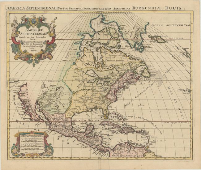
This large, decorative map is the fourth state of Jaillot's map of North America, first published in 1694 with the same decorative title and scale of miles cartouches. The map has been updated with the western Great Lakes now complete, California depicted as a peninsula, and the Mississippi River completely re-engraved. Florida is also now shown as an archipelago, and there are significant changes along the Gulf Coast, with the addition of several bays to the east of the Mississippi River and barrier islands added along the Texas shore. However, several geographical misconceptions still remain. Buttons Bay is open-ended, allowing the possibility of an inland passage to the Pacific. The R. del Norte originates from a large lake and empties into the Mer Rouge (Gulf of California), and the Terre de Iesso Ieco (Japan) appears just a short distance off the northwestern coast of California. The continent is divided between the colonial interests of England, France and Spain. A Latin title appears above the map: "America Septentrionalis in Suas Praecipuas Partes Divisa, ad Usum Serenissimi Burgundiae Ducis."
References: Burden #700.
Condition: A
A dark impression with full contemporary color in the map and later color in the cartouches on a sheet with two small elephant watermarks. There is a bit of extraneous creasing along the centerfold at bottom and a professionally repaired tear at bottom center.