Subject: Western Hemisphere - America
Period: 1797 (dated)
Publication:
Color: Hand Color
Size:
23 x 20.8 inches
58.4 x 52.8 cm
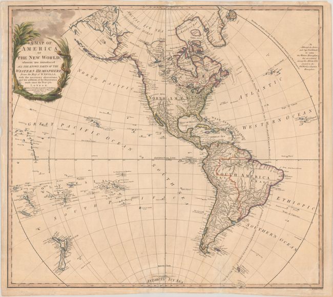
Originally drawn by D'Anville in 1761, Faden's version was updated with corrections and new discoveries. The map depicts the United States extending to the Mississippi River, and the region to its west is under Spanish rule with Louisiana and New Mexico named. The majority of the northwest part of the continent is blank with Quivira shown by itself in the Plains. In South America, the fictitious lakes Parima and Xarayes appear. Numerous rivers, mountain ranges, and lakes are shown and named, as well as the names of Indian tribes. While many disputed features are not mapped, some are noted, such as the Sea of the West identified by three names but not completely drawn. The decorative cartouche shows an exotic tree, a snake twisting around a column of tall grass, and the phrase "O Rare Columbus" in the sky and clouds.
References: McGuirk #226.
Condition: B+
A nice impression on a lightly toned sheet with light soiling and archival repairs to some edge tears, extending between 0.5" to 2" into the image.