Subject: Western Hemisphere - America
Period: 1745 (dated)
Publication:
Color: Hand Color
Size:
24.3 x 19.3 inches
61.7 x 49 cm
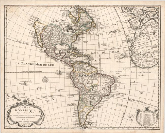
Guillaume Delisle's map of the Americas, first published in 1722, was one of the most popular maps of the 18th century with numerous editions spanning nearly 100 years. This is an unchanged reissue of the 1722 plate with Buache's imprint added at bottom right. This detailed map of the Americas provides a great deal of information about the state of geographic knowledge in the New World in the early part of the century. In North America the western coast is blank above California. The French territory of Louisiane takes up the lion's share of North America at the expense of the British colonies. This political bias was due to Delisle's position as geographer to the King of France. South America is well represented with a good depiction of the river systems and the locations of the Jesuit missions. A small Brazil adjoins the Pays des Amazones. A garland style title cartouche and another cartouche containing notes on the map decorate the lower corners.
References: Tooley (America) p. 13, #5.
Condition: B+
A sharp impression on watermarked paper with minor staining in the top left corner and a few archivally repaired edge tears that just enter the map image at bottom. The top margin has been replaced with old paper, with the upper neatline replaced in facsimile.