Subject: Southern Africa
Period: 1699 (circa)
Publication:
Color: Hand Color
Size:
11.3 x 7.9 inches
28.7 x 20.1 cm
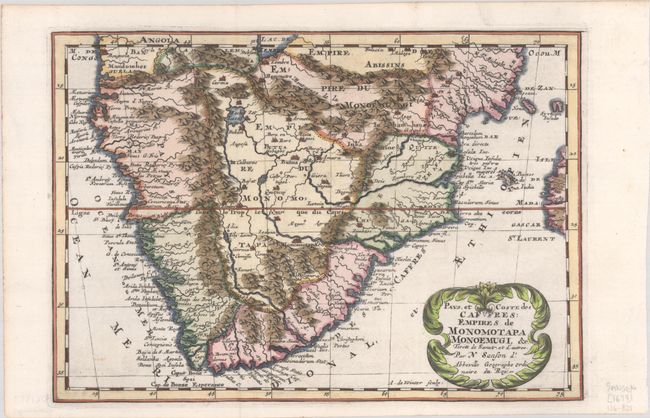
This charming map of the southern part of Africa is fully engraved with mountains, several large rivers, and lakes. The kingdom of Monomotapa covers most of the interior, and a city of the same name sits on the bank of the Spiritus River. Rivers flowing from the Mountains of the Moon (Montagnes de la Lune) feed an unnamed lake at top that appears to be the mythical Lake Zaire. The coast is dense with place names. Engraved by Antoine de Winter. This is the second state with the addition of a graticule.
Sanson's small maps from his L'Afrique en Plusieurs Cartes..., first published in 1656 and engraved by A. Peyrounin, were copied several times by various map publishers. Johann David Zunners made copies of Sanson's maps for his German translation of Die Gantze Erd-Kugel in 1679. Johannes Ribbius and Simon de Vries published copies in 1682 and 1683, with new maps engraved by Antoine d'Winter. The plates were later sold to Francois Halma, who used them in 1699 and then again in 1705 with the titles re-engraved in Dutch. The titles on the d'Winter plates were re-engraved back into French, and then used by Nicholas Chemereau in 1715 and by Henri du Sauzet in 1738.
References:
Condition: A
A dark impression on a bright sheet, issued folding with a short tear along the left edge of the sheet.