Subject: Japan & Korea
Period: 1658 (circa)
Publication:
Color: Hand Color
Size:
20.5 x 14.6 inches
52.1 x 37.1 cm
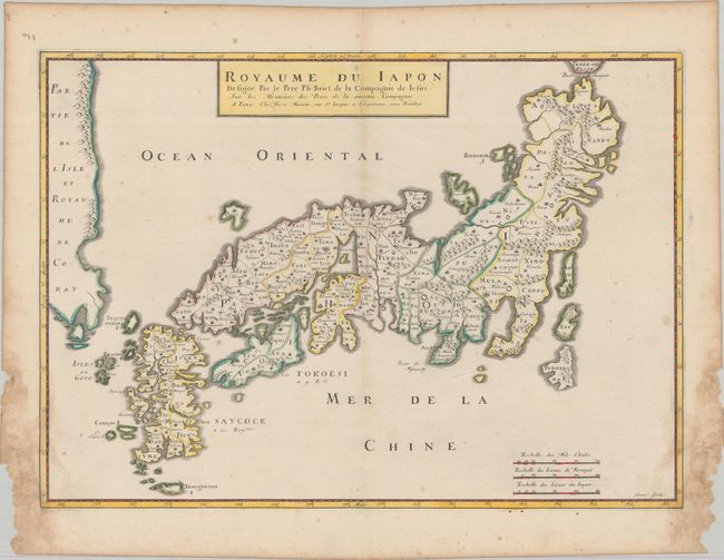
This beautiful and uncommon map of Japan is based on the Blancus/Moreira type, and nearly identical to the unpublished Christophoros Blancus map of 1617. The map shows a well-shaped Japan with named provinces, and major cities including Yendo (Tokyo) and Meaco (Kyoto). Kyushu and Shikoku are shown with exaggerated inlets, and the tip of Hokkaido is Terre de Iesso. Korea is described as an island but is only partially shown. Engraved by Somer. This is the second state with additional place names, including Iamaysoit, Ietsen, Ietsegen, Quanto, and Ochior. It was published by Mariette in an edition of Cartes Generales de Toutes les Parties du Monde... (1658-70) or Cartes Generales de la Geographie Ancienne et Nouvellle… (1676).
References: Hubbard #31; Walter #32, OAG #31.
Condition: B+
A fine impression with contemporary outline color on a sheet with a large coat of arms watermark. There are dampstains in the bottom corners that just barely cross the neatline into map image, with a few minor chips that are confined to the margins and have been archivally reinforced on verso.