Subject: Holy Land
Period: 1651 (published)
Publication: La Terre Sainte en Six Cartes Geographiques…
Color: Hand Color
Size:
21.2 x 15.5 inches
53.8 x 39.4 cm
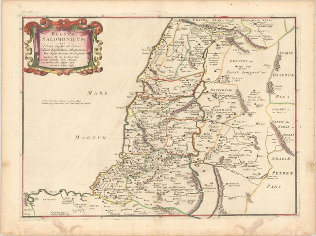
Very handsome map of the Holy Land during the reign of King Solomon, showing the provinces of the Twelve Tribes. Solomon reigned over a large region that included Damascus in the north and the entire area east of the Jordan. The Mediterranean coastline is depicted from Sidon to Sirbon Lacus. Haifa Bay is enlarged and there is an imaginary bay south of Jaffa. The map is adorned with a lovely drape and ribbon-style cartouche.
References: Laor #417; Pastoureau, LA RUE [3].
Condition: A
A dark impression with contemporary outline color in the map and later color in the cartouche, on a bright sheet with a large coat of arms watermark. There is light printer's ink residue, some damp stains confined to the blank margins, and an old paper repair in the right blank margin on recto.