Subject: Holy Land
Period: 1632 (published)
Publication:
Color: Hand Color
Size:
33.1 x 12.7 inches
84.1 x 32.3 cm
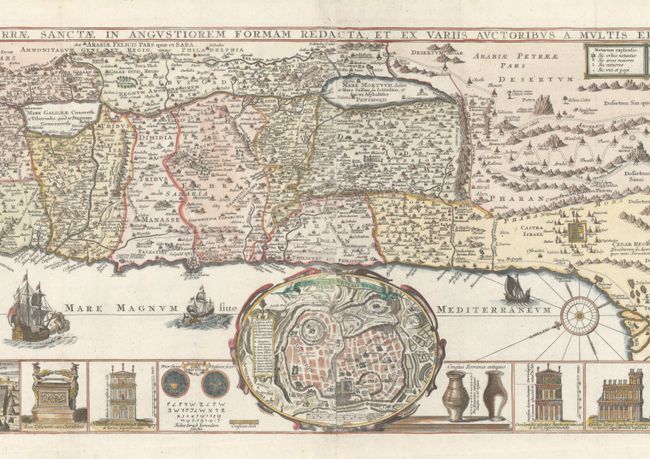
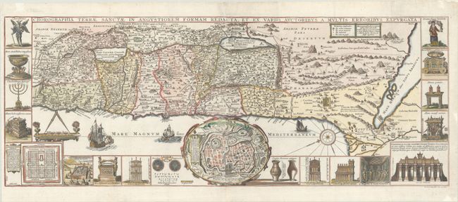
Panels illustrating sacred objects surround this stunning map of the Holy Land. Oriented with east at top, the map includes the territories of the twelve tribes on both sides of the Jordan River and the route of the Exodus and Wandering. At center is an inset bird's-eye plan of ancient Jerusalem based on the Spanish biblical geographer, Juan Bautista Villalpando. The decorative panels include a menorah, the arc of the covenant, the altar of sacrifices, the Tabernacle, and a plan and elevations of the Temple. Two sheets joined as issued.
References: Laor #771.
Condition: A
A sharp impression on bright sheets with a coat of arms watermark, issued folding. There are professional repairs to a couple of short fold separations in the margins and to a chip at top left.