Subject: Western Wales
Period: 1645 (circa)
Publication: Theatrum Orbis Terrarum sive Atlas Novus Pars Quarta
Color: Hand Color
Size:
19.6 x 15.1 inches
49.8 x 38.4 cm
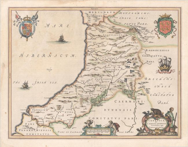
This lovely, decorative map of the Welsh county of Cardiganshire (now known as Ceredigion) identifies villages, settlements, rivers, lakes, mountains, and forests. The Royal Coat of Arms within the Garter is featured at left, with the Coat of Arms of Wales and the Prince of Wales' Feathers at right. The map features a title cartouche surrounded by birds, fish, beavers, and a hunter, as well as a scale of miles cartouche with putti using a surveyor's chain. The map is adorned with two ships in the Irish Sea. Latin text on verso, published 1645-46.
References: Van der Krogt (Vol. II) #5540:2.
Condition: B+
A crisp impression with full contemporary color, minor soiling and foxing, and a couple small rust spots.