Subject: Southeastern England
Period: 1676 (circa)
Publication: The Theatre of the Empire of Great Britaine
Color: Hand Color
Size:
19.8 x 14.9 inches
50.3 x 37.8 cm
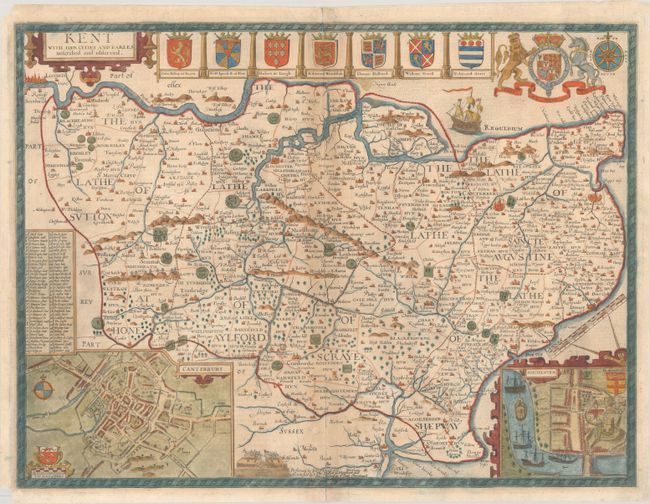
This highly decorative map of Kent provides fascinating detail of the county, with London shown at the top left corner of the engraving. Inset plans of Canterbury and Rochester are included at bottom. A lovely border surrounds the map along with the royal crest, the arms of nine Earls, a compass rose, a sailing ship, and a battle scene. Includes the imprint of Bassett and Chiswell. English text on verso.
References: Shirley (BL Atlases) T.SPE-1j.
Condition: B
There is light toning along the centerfold, some creasing at bottom center, and archival repairs to centerfold separations at top and bottom and to a small hole in an unengraved area at bottom center. There are small remnants of paper tape along the edge of the sheet on verso, and small chips in two corners of the sheet.