Subject: Northern England
Period: 1610 (dated)
Publication: The Theatre of the Empire of Great Britaine
Color: Hand Color
Size:
20.1 x 15.1 inches
51.1 x 38.4 cm
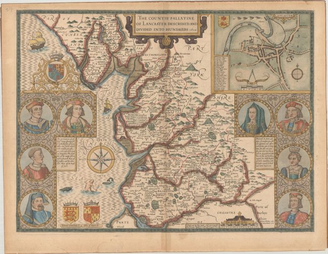
This county map of Lancastershire is divided into hundreds and displays interesting detail including the locations of towns, beaches, rivers, forests and parks. An inset at top right shows the city of Lancaster with a key to 22 important locations. Flanking the map at left are portraits of Henry IV through VII (Lancaster Kings), and at right are portraits of Edward IV and V, Richard III, and Queen Elizabeth I (York Kings/Queen). The map is further adorned by three coast of arms, two sailing ships, sea monster, mermaid, and compass rose. Engraved by Jodocus Hondius and sold by Bassett & Chiswell, circa 1676. English text on verso.
References: Shirley (BL Atlases) T.SPE-1e.
Condition: B+
Attractive color with wide margins. There is some light toning mostly along the centerfold and sheet edges.