Subject: Britain
Period: 1854 (dated)
Publication: The Physical Atlas of Natural Phenomena
Color: Printed Color
Size:
24.3 x 20 inches
61.7 x 50.8 cm
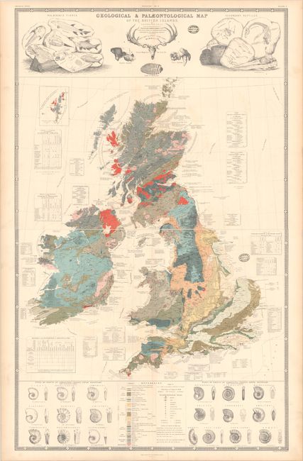
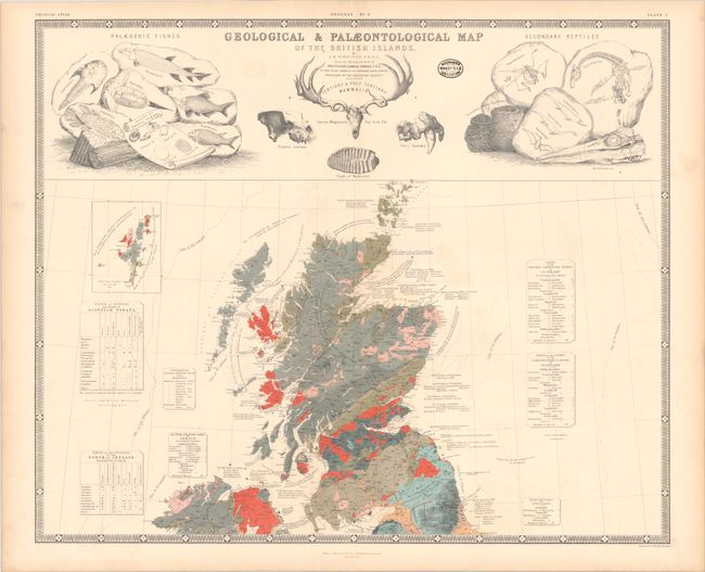
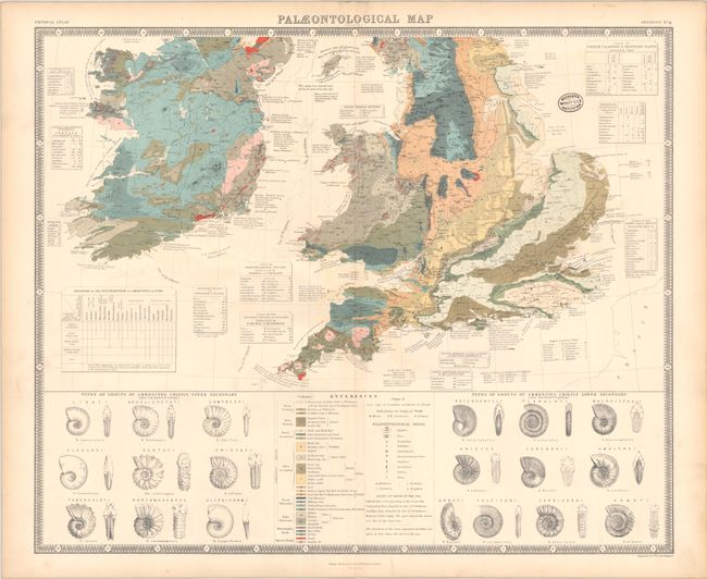
These two maps together describe the geology of Great Britain. The first map is the northern sheet which carries the full title in a panel with engraved vignettes of skeletons, fossils, and the head of a Saber-toothed Tiger. The lower sheet contains the legend which identifies an amazing 25 different geological types. To the sides of the legend are numerous fossil ammonites. Both sheets are filled with notations and tables. The maps are from the Sketches and Notes of Professor Edward Forbes, F.R.S., President of the Royal Geological Society. Surrounded by a keyboard-style border. If combined, the full map would measure approximately 24.3 x 40".
Each map has the small stamp of the Wakefield Mechanics Institution. Established during the Industrial Revolution, the Mechanics Institution movement in Britain intended to provide adult education for the working man. At a time when most libraries were available only to subscribers, the Mechanics Institutions frequently became the libraries of the working class. Formed in 1841, the Wakefield Mechanics Institution was dissolved in 1935 and its library dispersed.
References:
Condition: B+
Contemporary color on sturdy sheets with light color offsetting and minor toning along the sheet edges. There are old library stamps on recto and verso. The first image is a composite image - the map is in two separate sheets.