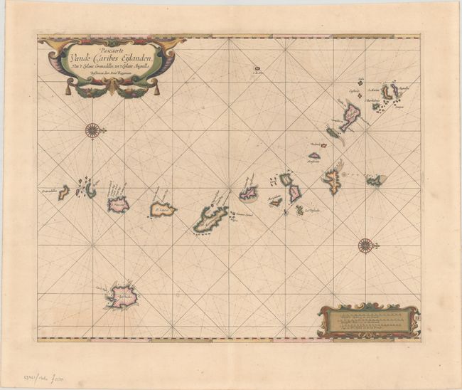
Subject: Lesser Antilles
Period: 1675 (published)
Publication: Het Eerste Deel van het Brandende Veen
Color: Hand Color
Size:
20.1 x 16.2 inches
51.1 x 41.1 cm
This very rare Dutch sea chart is one of the first large-scale charts to focus on the Lesser Antilles. The map is oriented with north to the right and depicts the islands from Anguilla and St. Martin to the Grenadines. The islands are still mis-shapen and many of the smaller islands are missing or unnamed. The chart is adorned with two strapwork cartouches. This chart appeared in Roggeveen's Het Brandende Veen (The Burning Fen), which was published by Pieter Goos in 1675. As a result of Goos' death that same year, and Roggeveen's death several years later, the plates were sold to Jacobus Robijn, who issued a second edition in 1689 and a third edition in 1698. This example is from the first edition, prior to the addition of Robijn's imprint within the title cartouche. This chart is rarely offered on the market, especially in the first state.
References: Shirley (BL Atlases) M.ROG-1a.
Condition: A
Crisp impression with full contemporary color on a bright sheet with a hint of offsetting and some minor paper flaws. Small remnants of hinge tape along the top edge of the sheet, which has been folded over.