Subject: Jamaica
Period: 1778 (dated)
Publication:
Color: Black & White
Size:
24.3 x 18.4 inches
61.7 x 46.7 cm
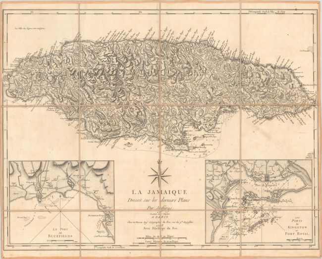
This uncommon chart is the French version of the 1775 map by Thomas Jefferys. The map of the island is extremely detailed, depicting parishes, towns and villages, churches, forts, roads, rivers and ponds, harbors, anchorages, soundings, etc. A notation at upper left translates as: "The Negro-towns are Distinguished by a Stroke under the Name." Two large inset maps show the towns and ports of Bluefields and Kingston and Port Royal. Above the title is a large French-style compass rose. Segmented and mounted on 18th-century linen with paper label on verso labeled in manuscript brown ink.
References:
Condition: B+
Fine sharp impression with minor soiling, a few spots of foxing, and narrow side margins, as issued.