Subject: Caribbean & Bermuda
Period: 1759 (circa)
Publication:
Color: Hand Color
Size:
22 x 19.4 inches
55.9 x 49.3 cm
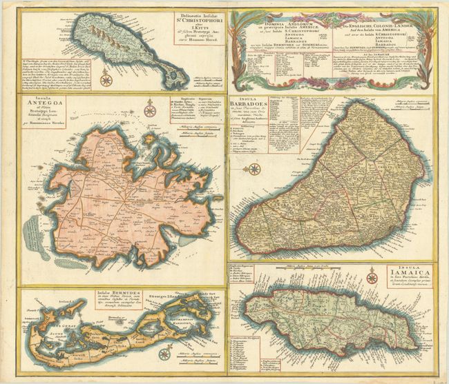
A large and striking sheet that contains five charts describing the islands of St. Kitts, Antigua, Bermuda, Barbados, and Jamaica. All of these maps were copied from separate maps made by Herman Moll in 1729. Each is finely engraved and meticulously detailed with its own compass rose, soundings, roads, forts, churches, topography, and political divisions, as well as descriptive text and place name keys. The map has a second title in German: Die Englische Colonie-Laender auf den Insuln von America. This is the second state with Bermuda changed from "Bermudos" to "Bermudes."
References: Evans (Bermuda) Homann's Heirs [1737]; Sellers & Van Ee #1723.
Condition: B+
On watermarked paper with minor abrasions along the centerfold and one in the title. Light dampstains are confined to the top blank margin.