Subject: World
Period: 1800 (dated)
Publication:
Color: Hand Color
Size:
26.1 x 17.8 inches
66.3 x 45.2 cm
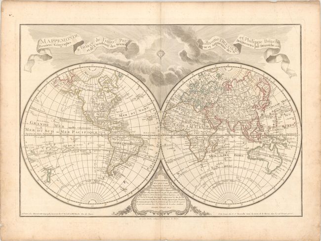
Dezauche, the successor to the Delisle cartographic firm, issued this impressive large double hemisphere map based upon the work of both Delisle and Bauche. The map shows well formed continents with the latest discoveries described in the cartouche at bottom. The western portion of North America is still largely blank but Alaska is shown in a rudimentary shape based on the discoveries of Captain Cook. Australia and New Zealand also reflect the discoveries of Captain Cook, whose routes are traced throughout the map, including several landfalls in Antarctica. There is a note in the newly discovered Isles Sandwich or O-Why-Hee (Hawaii) noting the date that Capt. Cook perished in 1779. The large title is in ribbon form, with the sun and clouds covering the upper portion of the map, and a decorative advertisement cartouche at bottom.
References:
Condition: B+
A nice impression on watermarked paper with light scattered foxing and soiling and a printer's crease in the top right corner.