Subject: World
Period: 1790 (circa)
Publication:
Color: Black & White
Size:
18.1 x 14.8 inches
46 x 37.6 cm
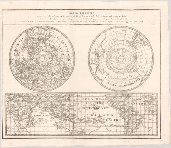
This uncommon map is a slightly-reduced version of Salvador Lirelli's map, which was published in 1786 for the Royal Academy of Science in Torino. The sheet includes two polar projections and a world map on Mercator's projection, centered on the Pacific. The focus of the maps is Captain Cook's voyages, which are traced throughout along with the dates of each leg of his travels. The south polar hemisphere depicts mountains of ice surrounding the pole, but no landmass is shown. The map on Mercator's projection shows Australia named Nuova Olanda and still connected to Tasmania, although the coastline is beginning to take shape. Engraved by P. Amati and P. Tela.
References: cf. Tooley (MCC-2) #79.
Condition: A
A sharp impression on a bright sheet, issued folding with a paper flaw at bottom center and a narrow left margin.