Subject: Quebec City, Canada
Period: 1764 (circa)
Publication: Le Petit Atlas Maritime
Color: Hand Color
Size:
13.7 x 8.4 inches
34.8 x 21.3 cm
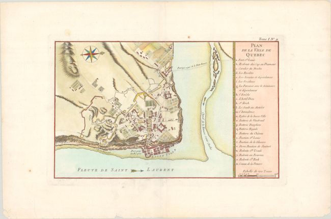
This attractive and historical map of Quebec presents the city as it would have appeared before the French surrendered at the end of the French and Indian War. It is based on earlier plans by Bellin, first published in 1744, that continued to be the definitive view for many years. The list at right names and keys 24 buildings, batteries and forts; it locates Fort S. Louis, the Hotel Dieu and St. Roch. The map locates Ancient retrenchment, the high village, and more. This terrific plan is oriented with north to the right as indicated by a decorative compass rose with fleur-de-lis.
References: Kershaw #1054.
Condition: A
A crisp impression on a clean sheet with a few gilt highlights. There are a couple of extraneous creases and minor edge chips/tears all confined to the blank margins.