Subject: Newfoundland, Canada
Period: 1764 (circa)
Publication: Le Petit Atlas Maritime - Volume 1
Color: Hand Color
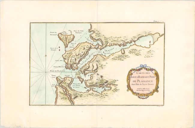
A. Carte des Bayes, Rades, et Port de Plaisance dans l'Isle de Terre-Neuve (13.9 x 8.6"). This chart focuses on Placentia and Argentia harbors on the Avalon Peninsula in Newfoundland. The French fort, village, and battery are shown at the harbor entrance. These harbors were used to overwinter fleets, and the harbors are so marked.
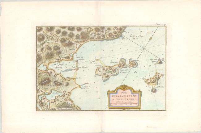
B. Plan de la Rade et Port de l'Isle St. Pierre (13.1 x 8.6"). This map depicts the eastern part of the island of St. Pierre, situated off the southern coast of Newfoundland. It presents the island's rugged terrain, neighboring small islands, and numerous soundings in the water. Located near the famed fishing grounds of the Grand Banks, this small island became the only French possession in North America following the French-Indian War.
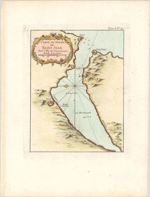
C. Carte du Havre de Saint Jean dans l'Isle de Terre-Neuve (6.4 x 8.3"). This small map shows the vicinity of St. John's Harbor, which is well protected by three forts and a "chain" crossing the entrance to the harbor. While no settlements are named, Habitations are noted along the coastline. Decorated by a rococo-style cartouche.
References: Kershaw #534 & #536.
Condition: A
Crisp impressions on clean sheets of watermarked paper with a few gilt highlights.