Catalog Archive
Auction 192, Lot 116

"Neue Karte von Ober und Unter Canada", Stockdale, John

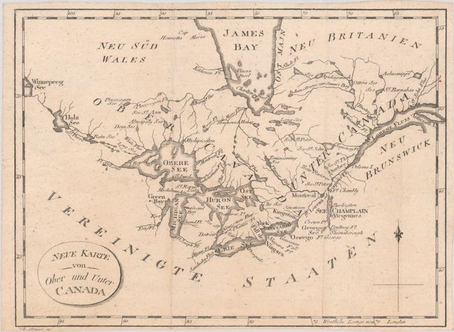
Subject: Eastern Canada, Great Lakes

Period: 1801 (published)

Publication:

Color: Black & White

Size:
8.9 x 6.6 inches
22.6 x 16.8 cm
Download High Resolution Image
(or just click on image to launch the Zoom viewer)

A German issue of Stockdale's handsome map of the Great Lakes and Canada from Isaac Weld's Travels through the States of North America. Centered on the Great Lakes, the map extends from Lake Winnipeg in the west to the mouth of the St. Lawrence and Anticosti Island. There is nice detail of watersheds, shoreline and the southern portion of James Bay. The map locates a number of important forts including Ft. Chambly and Ft. George. Engraved by Joh. Stenger.

References: Kershaw #994.

Condition: A

A nice impression, issued folding on a watermarked sheet with narrow margins.

Estimate: $100 - $130

Sold for: $50

Closed on 4/26/2023

Archived