Subject: Eastern Canada
Period: 1780 (circa)
Publication: Atlante Novissimo...
Color: Hand Color
Size:
16.6 x 12.1 inches
42.2 x 30.7 cm
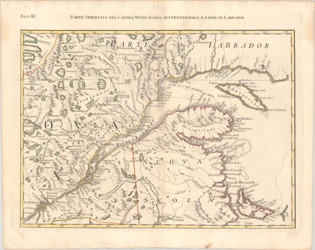
This map is one sheet of the Italian version of Mitchell's seminal map of the British Dominions in North America that Zatta issued in 12 sections with the whole titled "Le Colonie Unite dell' America Settentrle." The map covers part of New Brunswick, Anticosti Island and the St. Lawrence River, and depicts the navigational route from the Gulf of St. Lawrence to Quebec.
This example is accompanied by a copy of the map printed on a transparency sheet.
References: Kershaw #1012; Shirley (BL Atlases) T.ZAT-1a, Vol. 4, #30.
Condition: B+
A crisp impression with contemporary color on a bright sheet with the watermarks of three crescent moons and "Mezana." There is a hint of toning along the centerfold, a couple of abrasions along the centerfold near the northern bank of the St. Lawrence River, and light dampstains in the top corners of the sheet.