Subject: Eastern Canada
Period: 1753 (circa)
Publication: The English Pilot, The Fouth Book
Color: Black & White
Size:
22.2 x 17.2 inches
56.4 x 43.7 cm
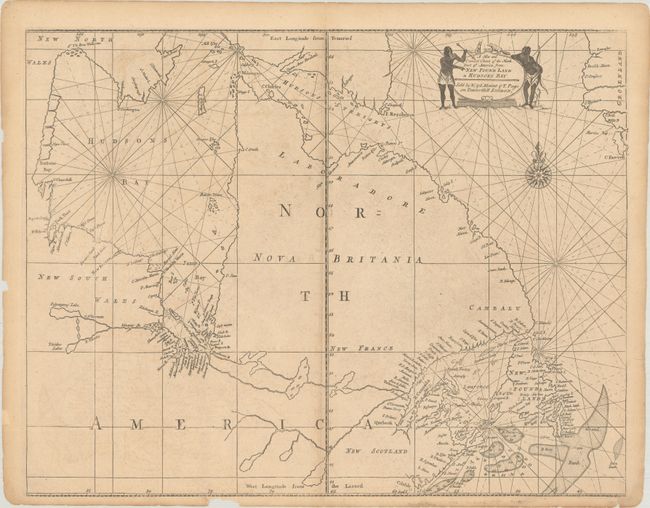
Fourth state of this important sea chart focusing on the coastal features of Hudson Bay and Labrador from the plate by John Thornton. Hudson and James bays are well-depicted for the period. Labrador, Quebec and the Ungava Peninsula are shown as being separated from the rest of Canada by the Frenchman River, shown reaching all the way from James Bay to Atlantic. Soundings are noted in the fishing banks. The title cartouche is flanked with Native figures and animals, and rhumb lines along with a fine compass rose complement the map.
References: Verner and Stuart-Stubbs #31; Kershaw #222.
Condition: B+
A lightly toned sheet with a bit of offsetting, centerfold separations at top and bottom that have been closed on verso with archival tape, and some chips along the edges of the sheet, not affecting the image.