Subject: Canada
Period: 1802 (dated)
Publication:
Color: Hand Color
Size:
11.4 x 7.4 inches
29 x 18.8 cm
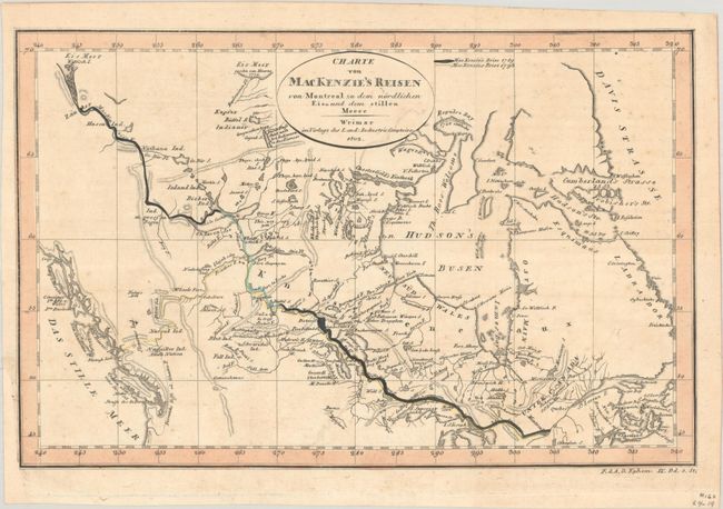
Alexander Mackenzie was the first white man to cross the North American continent north of Mexico and thus dispel the belief in a Northwest Passage to Hudson Bay. His epic journey was one of incredible hardship and marks an important page in the cartographic history of North America. This map is a reduced German version of the general map titled "A Map of America, from Latitudes 40 and 70 North, and Longitudes 45 and 180 West, exhibiting Mackenzie's Track from Montreal to Fort Chipewyan & from thence to the North Sea in 1789 and to the West Pacific Ocean in 1793," first issued in 1801. The map shows the entire track of both the 1789 and 1793 expeditions from Montreal to the Arctic Sea and Pacific Ocean.
The first expedition set out in 1789 to test Peter Pond's theory that Cook Inlet was the mouth of a large westward-flowing river that would provide a route to the Pacific. After a most difficult 2500 km canoe trip, the expedition found itself at the Arctic Ocean, not the Pacific. The second expedition set out in May 1793, with men and Indians from the Beaver tribe. After a long journey traveling via rivers and over land, Mackenzie finally arrived at the Pacific Ocean. The map details both expeditions via hand coloring. The map is finely engraved with good overall detail showing major waterways, lakes, and a few mountain ranges. An uncommon map in this issue.
References:
Condition: B+
Issued folding and now flattened and backed with tissue. There is some minor foxing and a small binding trim at lower left that has been replaced with old paper.