Subject: North America
Period: 1873 (circa)
Publication: Mission of the North American People, Geographical, Social and Political
Color: Hand Color
Size:
22.5 x 23.8 inches
57.2 x 60.5 cm
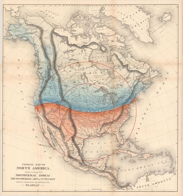
Based upon Alexander von Humboldt's "isothermal zodiac," this map of North America shows a large temperate range south of the 40th parallel. Gilpin was a strong believer in climate influencing economic development, and the map suggests that the United States was well positioned to benefit from the favorable conditions. Additionally, the map uses concentric circles to represent the future population density with the center of population at Topeka, Kansas.
Gilpin was the first governor of Colorado Territory and a proponent of the concept of Manifest Destiny, the transcontinental railway, and a westward expansion of the United States. He had radical ideas on how and why America should be populated, and to support his theories he created a series of maps including this one. Interestingly, Gilpin's maps were some of the first to show economic potential for the West and to think in terms of regional resources and climates.
References:
Condition: B+
Issued folding with two 1" edge tears at left and a short fold separation at right that have all been closed on verso with archival tape. A previous owner's stamp is visible on verso.