Subject: Colonial North America
Period: 1771 (circa)
Publication: A New System of Geography...
Color: Black & White
Size:
14.6 x 13.1 inches
37.1 x 33.3 cm
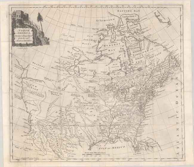
This map was issued four years prior to the Revolutionary War and shows good detail in the east with Virginia, the Carolinas, and Georgia extending to the Mississippi River. The Gulf Coast is comprised of East and West Florida, with West Florida also extending to the Mississippi. There are numerous early frontier settlements, forts, and Indian nations located. Buffaloes Meadows are identified near present-day Iowa. In the Pacific Northwest, the Straits of Juan de Fuca open up to a huge, but undefined Western Sea. The River of the West conjecturally flows from Pikes Lake in the Intermountain West. New Albion, the Snowy Mountains, and Teguayo & Quivira are prominently shown, but the western region is mostly blank. The Missouri River is partly delineated with "the head of this River unknown." New Mexico is a large area that includes Texas with several Indian pueblos located. Central Canada has a bizarre set of lakes and river systems as is commonly seen in this period. Engraved by Thomas Kitchin and published in Daniel Fenning's A New System of Geography.
References: McGuirk #126; McCorkle (18th C. Geography Books) #107-23.
Condition: B+
Issued folding and now flat with an archivally repaired 3" edge tear at right. A binding trim at upper right has been skillfully replaced with old paper.