Subject: Western Hemisphere - America
Period: 1817 (dated)
Publication:
Color: Hand Color
Size:
46.6 x 33.9 inches
118.4 x 86.1 cm
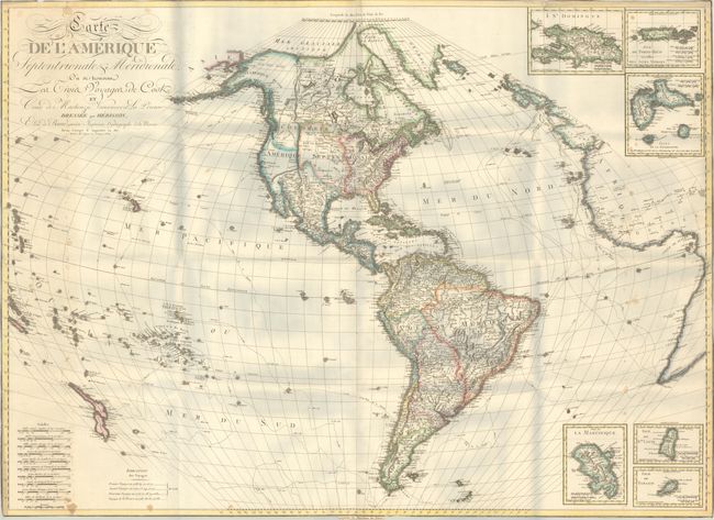
This uncommon French wall map of the Americas shows the three voyages of Captain Cook, along with the tracks of Vancouver, Mackenzie, and La Perouse. The map extends beyond the Americas to include nearly all the South Pacific with both islands of New Zealand shown. It also extends to show western Europe and Africa. The United States reaches to the Mississippi River with Louisiana Territory to the west and Florida is still under Spanish control. In the Pacific Northwest, British claims extend south of the Columbia River. In South America a small remnant of Lake Parime is still shown. Six insets feature islands in the West Indies. Printed on two sheets, joined.
References:
Condition: B
A crisp impression on bright sheets with light toning along the left edge of the sheet and small dampstains along both sides of the map. The map has been trimmed to the neatlines and folded with tiny tears along the edges.