Subject: References, Britain
Period: 1990-92 (published)
Publication:
Color: Printed Color
Size:
10.5 x 14.3 inches
26.7 x 36.3 cm
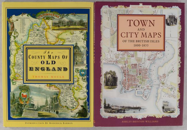
A. The County Maps of Old England, by Thomas Moule, published 1990. This fine book collects 56 of Thomas Moule's charming English county maps, accompanied by the original text from Barclay's Complete and Universal English Dictionary. As Roderick Barron writes in his terrific introduction, "Their elaborate and decorative style, a synthesis of art and cartography, sets them apart from most other maps of the period." The maps are reproduced in full color. 126 pages. Hardbound in dark navy cloth with gilt title on spine and an illustrated dust jacket. Condition: Contents are near fine. Covers slightly bumped in the lower corners.
B. Town and City Maps of the British Isles 1800-1855, by Ashley Baynton-Williams, published 1992. This beautifully illustrated reference focuses on intricately decorated maps of English cities. It features an interesting selection of 56 town and city views, all in full color, representing the work of nine leading cartographers, including Tallis, Moule, and Cole & Roper. 128 pages. Hardbound with pictorial dust jacket. Condition: Contents and covers are like new. Dust jacket has minor shelf wear.
References:
Condition: A
See description above.