Subject: Atlases
Period: 1825 (published)
Publication:
Color: Hand Color
Size:
15 x 21.8 inches
38.1 x 55.4 cm
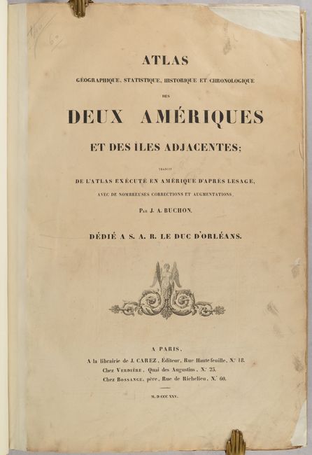
This very attractive atlas is from the French edition of Carey & Lea's American Atlas. Included are 63 maps and tables of North America, South America, the United States and the West Indies. Each of the maps (53 total) is surrounded by text including economic, political, social and historical data. Of particular interest are the following maps:
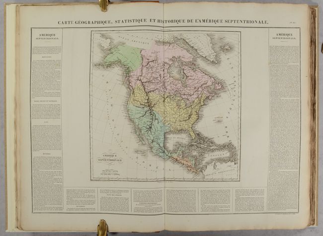
Carte Geographique, Statistique et Historique de l'Amerique Septentrionale (14.3 x 14.0"). The United States extends to the Pacific Ocean and reaches far north into Canada showing the boundary that becomes the Fifty-Four Forty or Fight dispute between England and the U.S. Alaska is Amerique Russe with good detail and place names along the coastal region, but a fully blank interior. Many Indian regions are noted throughout. In Texas (unnamed) only a few places are named; S. Antonio, Rancho, Matagorda, and San Saba. A bizarre mountain range diagonally crosses the Great Basin from Utah and nearly reaches the coast in the direction of San Clemente. The R. del Carmelo ou St. Phelipe, originating in L. Teguanyo ou Salo, freely runs through the Great Basin to its mouth at Monterrey.
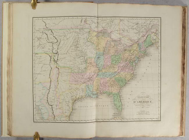
Etats-Unis d'Amerique (21.0 x 16.8"). This map is directly derived from John Melish's seminal map of the United States. The large Arkansas Territory takes in most of present-day Oklahoma; the new state of Missouri has a vertical western border; Michigan Territory includes most of present-day eastern Wisconsin; and the Northwest Territory takes in present day Wisconsin and Minnesota. The balance of the Midwest is included in the Territoire d'Oregon and is filled with information on numerous Indian tribes. The Grand Desert Americain takes in the southern plains region. Texas is a part of Mexico.
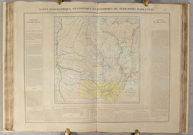
Carte Geographique, Statistique et Historique du Territoire d'Arkansas (14.2 x 14.1"). Reflecting Major Stephen H. Long's exploratory expeditions, this is an important map of the early western territories, focusing on the large Arkansas Territory, and depicting an early western border in Missouri. The map extends to the Rocky Mountains, and the plains are labeled Grand Desert. Numerous Indian villages are shown based on information gained from the Lewis and Clark expedition, and other important exploration routes are shown. The map shows Arkansas Territory extending to include present-day Oklahoma. The western portions of the map are identical to Long's map of 1823, also published by Carey & Lea.
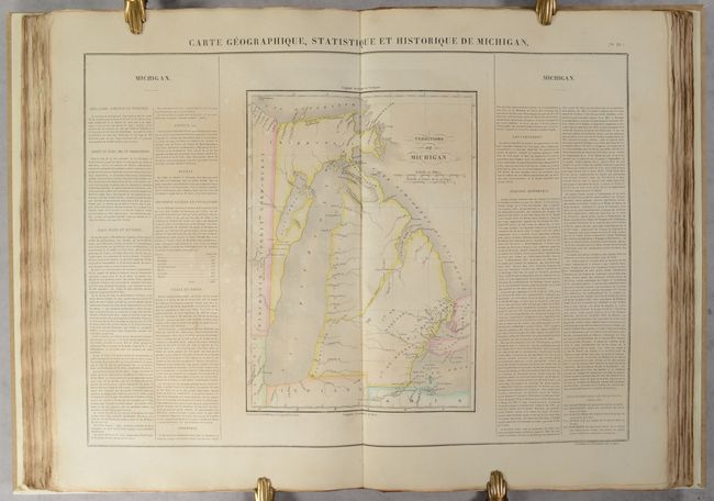
Carte Geographique, Statistique et Historique de Michigan (10.3 x 14.2"). This fine early map of Michigan Territory depicts a western boundary on a line 10° 30' West Longitude from Washington, resulting in Green Bay and a strip of present-day Wisconsin being incorporated into Michigan. The Frontiere Indienne divides lower Michigan on a diagonal line. The only settlements shown are in the southeast around Detroit, and along the Saginaw River is a Nouveaux Etablissements. The initial counties of Michilimakinak, Monroe, Oakland, DeWayne and Macomb are named but not delineated. There is a road depicted from Ft. Wayne, Indiana to Mt. Clemens. The rest of the territory is virtually blank except the a few portages and Indian villages. Several battlegrounds from the War of 1812 are located by tiny flag symbols.
Large folio. Handsomely rebound in quarter tan leather over paper-covered boards with gilt title on spine. Text block has deckled edges.
References:
Condition:
The maps are in contemporary color with 18 in near fine (A) condition and 25 in very good (B+) condition with light toning or foxing. Ten of the maps are in good (B) condition with moderate toning or foxing. The title page is toned and soiled with two large chips that have been repaired with archival paper. The new binding is in excellent condition with a few minor spots of fubbing.