Subject: Atlases
Period: 1762 (circa)
Publication:
Color: Hand Color
Size:
3.2 x 4.4 inches
8.1 x 11.2 cm
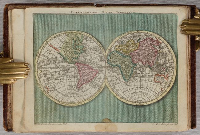
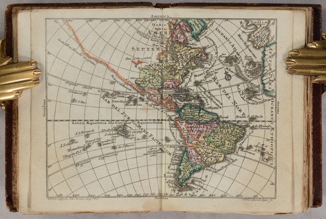
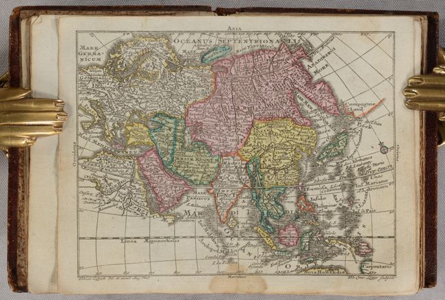
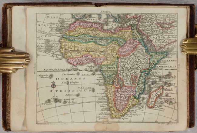
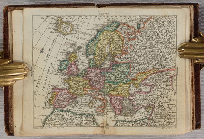
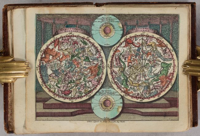
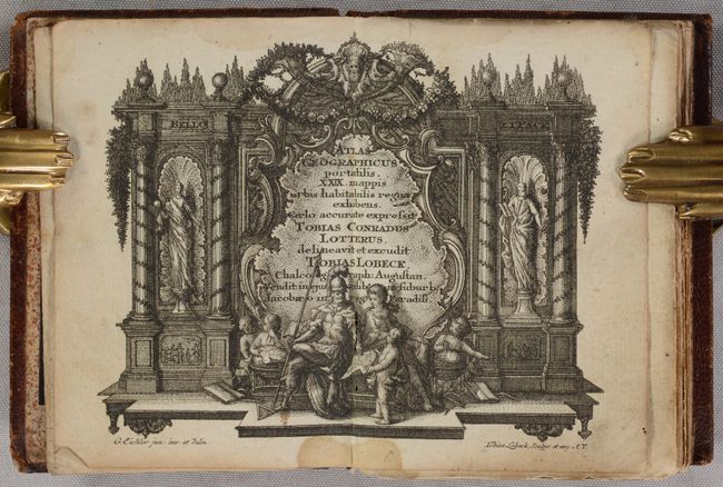
Fine pocket atlas with decorative maps in full contemporary color. It opens with a title page in an architectural cartouche, followed by an allegorical frontispiece, both drawn by Gottfried Eichler, junior. The maps include the celestial and terrestrial hemispheres, the continents, and detailed maps of western and eastern Europe. Most maps are embellished with a fine title cartouche. This atlas was a collaborative publication between Tobias Conrad Lotter and Tobias Lobeck, first published in 1747 with an almanac. The atlas remained in use for many years, with the maps reprinted and with new maps added, but the title page continued to report 29 maps. The maps present are:
1) Planisphaerium Globi Terrestris
2) Hemisphaerium Boreali [and] Hemisphaeriusm Australe
3) Europa
4) Asia
5) Africa
6) America
7) Regnorum Hispaniae et Portugalliae Tabula generalis
8) Totius Regn. Galliae sive Franciae Tabula
9) Nova Totius Italiae cum adjacentibus Maroribus et Minoribus Insulis
10) Republic di Genova
11) Status Ecclesiastici Magni que Ducatus Florentini Tabula
12) Magna Britannia complectens Angliae, Scotiae, et Hiberniae Regna
13) Tabula Gener. Totius Belgii qua Provinciae XVII Infer. Germaniae olim sub S.R.I. Circula Burgundiae
14) Germania Inferior
15) Potentissimae Helvetiorum Reipublicae Cantones Tredecim
16) Germania H. Romische Reich...
17) Cercle d'Autriche
18) Cercles de Baviere, de Suabe, de Franconie…
19) Vereinigte Niederlande, Spanische Niederlande, Herzogt. Brabant, Herzogt. Luxemburg, Graefsch. Flandern
20) Cercle de Saxonie…
21) Boheme, Morovia, & Saxonie, Lusace, Silesie…
22) Bohemiae Regnum in Circulos suos divisii
23) Borussiae Regnum cum Adjacentibus Regionibus
24) Regnum Daniae
25) Regnum Sueciae
26) Impericum Russiqum Omnisque Tartaria
27) Regni Hungariae Tabula Generalis
28) Tabula Dunabii Graeciae et Archipelagi.
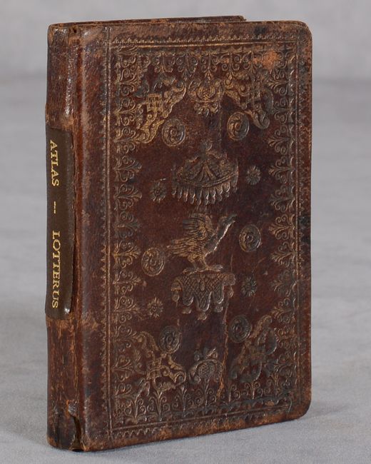
Following the maps is the list of maps, "Index mapparum Geograhicarum," which lists 29 maps. This example appears to be missing one map: Poloniae Regnum Magnusque Ducatus Lithuaniae. The atlas' collation does not, as often found, exactly match the list given on the Index. 12mo in full contemporary leather embossed with birds and flowers. A modern leather title label has been added to the spine. A lovely example of this uncommon atlas.
References: King (2nd Ed.) p. 171; cf. Mickwitz & Miekkavaara #134.
Condition: B+
The maps are in full contemporary color with occasional minor foxing and soiling. There is a very small dampstain along the centerfold at bottom that affects the first half of the volume. A previous owner's bookplate (Otto Oren Fisher) is pasted on the inside front cover. The covers are lightly worn and there is a small crack at the bottom of the spine.