Subject: Africa
Period: 1792 (dated)
Publication: Atlas Geographique et Universel
Color: Hand Color
Size:
23.3 x 18.1 inches
59.2 x 46 cm
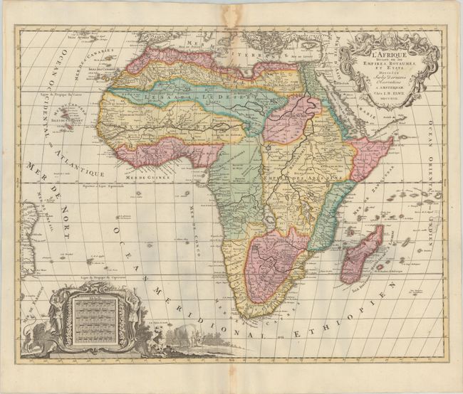
This handsome, large map of Africa was copied from Jaillot's popular and influential map from more than a century earlier (1674). The cartography is typical for the seventeenth century with the Nile originating in two large lakes below the equator. The River Zaire (Congo) also arises from Lake Zaire. The Kingdom of Monomotapa is shown with its capital on the Rio de Spirito Santa, and Vigiti Magna is also depicted. The map is richly embellished, also in the seventeenth century style, with two elaborate cartouches featuring allegorical figures and wild animals.
References: Norwich #109.
Condition: B+
A sharp impression with full contemporary color on a bright sheet with two elephant watermarks and a couple of minor printer's creases at left. There is light toning along the centerfold at the top and bottom of the sheet, and a chip at top center that just enters the border and has been archivally repaired.