Subject: Africa
Period: 1749 (dated)
Publication:
Color: Hand Color
Size:
26 x 19.3 inches
66 x 49 cm
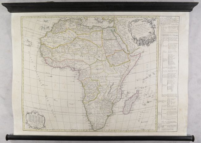
Gilles Robert de Vaugondy succeeded his uncle, Pierre Moulard Sanson, and thus based many of his maps on the large volume of accumulated records of the Sanson family. This is the uncommon first state of this map of the continent, credited to both engraved by Delahaye. It updates Sanson's geography with new information to present a detailed view of the continent with a great many tribal names. The source of the Nile is located in Lake Dambea. The title cartouche, engraved by Gobin, features a reclining figure, elephants, a lion, and a flying snake. Six distance scales are enclosed in a decorative cartouche at bottom left. A panel of French text at right provides information about political divisions, European possessions and religions. This example is a rare wall map edition, mounted on contemporary linen and attached to modern rollers.
References: Pedley #424.
Condition: B+
Contemporary outline color with light scattered foxing and soiling. The rollers are in very good condition with minor wear.