Subject: Sumatra, Indonesia
Period: 1764 (circa)
Publication: Le Petit Atlas Maritime
Color: Hand Color
Size:
13.9 x 8.5 inches
35.3 x 21.6 cm
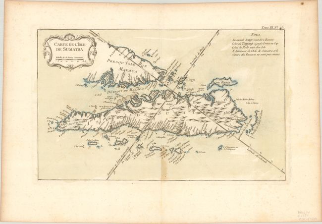
This finely engraved copper-plate chart shows all of Sumatra and the southern portion of the Malaysian peninsula. Singapore is not identified, but several other lesser islands are named including Tioman Island, Banca, and Penang. Good detail of the Straits of Malacca and the Detroit de Sincapour. The cities of Palembang, Jambi, Aceh, and Batang are located, but not Medan. A note at top right translates some of the native geographical words used in the map into French and also explains that the interior of the island and the courses of the rivers in Sumatra are not known. Decorative French rococo-style title cartouche.
References:
Condition: B+
A crisp impression with contemporary color on a watermarked sheet with light toning along the bottom centerfold and edges of the sheet.