Catalog Archive
Auction 191, Lot 696

Map Published at Outset of Sino-French War

"Le Tong-Kin et le Bassin du Fleuve Rouge d'Apres les Documents de J. Dupuis",

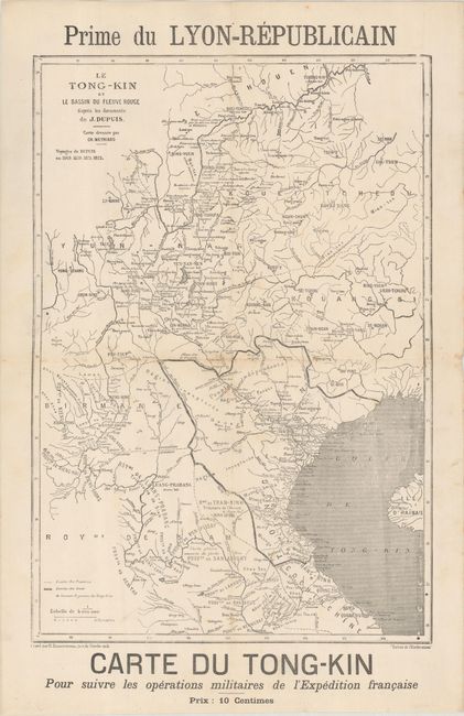
Subject: Southeast Asia, Vietnam

Period: 1883 (circa)

Publication:

Color: Black & White

Size:
11 x 16 inches
27.9 x 40.6 cm
Download High Resolution Image
(or just click on image to launch the Zoom viewer)

This map of Tonkin (now northern Vietnam) and surrounding areas was published at the outset of the Tonkin Campaign and Sino-French War. The map is based on the voyages of Joseph Dupuis between 1869-72. Depuis had explored the regions along the Red River in the hopes of establishing trade routes within Vietnam and China. The extensive river systems are well detailed, and numerous place names are included. Drawn by Ch. Meyniard and engraved by R. Hausermann. Created as a supplement to the Lyon-Republicain daily journal.

References:

Condition: B+

Issued folding with light foxing and a few small holes along the folds.

Estimate: $110 - $140

Sold for: $75

Closed on 2/8/2023

Archived