Subject: Asia
Period: 1749 (dated)
Publication:
Color: Hand Color
Size:
25.3 x 19.3 inches
64.3 x 49 cm
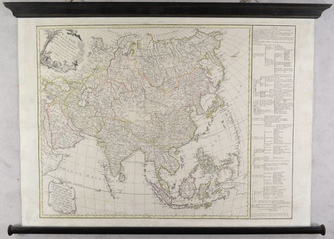
This is the uncommon first state of this terrific map of the continent. Gilles Robert de Vaugondy succeeded his uncle, Pierre Moulard Sanson, and thus based many of his maps, including this one, on the large volume of accumulated records of the Sanson family. It is an intricately engraved map with plenty of place names and topographical detail. Terre de Jedso (Hokkaido) is depicted as a peninsula attached to the mainland. There are six unlabeled islands west of the Mariana Islands. A stretch of coast north of Western New Guinea is identified as Terre elevee. East of Kamchatka, there is another partial coastline with a note that reads, "Terre vue en 1741 par M. Tchirikow." The decorative title cartouche, engraved by Gobin, depicts a mythical bird and a female figure reclining in the shade with a camel. Eight distance scales are enclosed in an ornate cartouche at bottom left. A panel of French text at right provides information about political divisions. This example is a rare wall map edition, mounted on contemporary linen and attached to modern rollers.
References: Pedley #373.
Condition: B+
Contemporary outline color with light soiling, a few small wormholes that have been infilled, and a tear in the text panel at right that has been repaired with archival materials. The rollers are in very good condition with light wear.