Subject: Persia - Iran
Period: 1780-87 (circa)
Publication:
Color: Hand Color
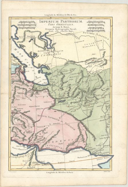
A. Imperium Parthorum. Pars Orientalis, from Atlas Portatif..., dated 1780, (8.8 x 12.6"). This handsome historical map covers the eastern part of the Parthian Empire. It centers on Aria seu Artacoana (present-day Herat) and stretches from the Caspian Sea to the Indus River. There are six distance scales at top. Engraved by Perrier with lettering by Andre. Condition: A crisp impression on thick, sturdy paper with a small spot at bottom left and faint offsetting. (A)
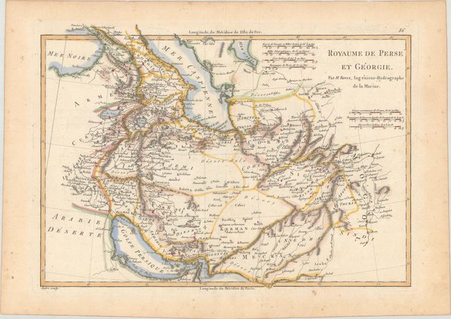
B. Royaume de Perse et Georgie, from Atlas Encylopedique, circa 1787 (13.6 x 9.6"). This is Bonne's smaller general map of the region. The map extends from Georgia into present-day Pakistan. It delineates political divisions, identifies deserts, and features many place names and some nice topographical detail. Includes 7 distance scales. Engraved by Andre. Condition: There is minor scattered foxing, a small spot of errant colorist's ink just north of the Turkmenbashi Gulf, and light toning. Remnants of hinge tape on verso. (B+)
References:
Condition:
See description above.