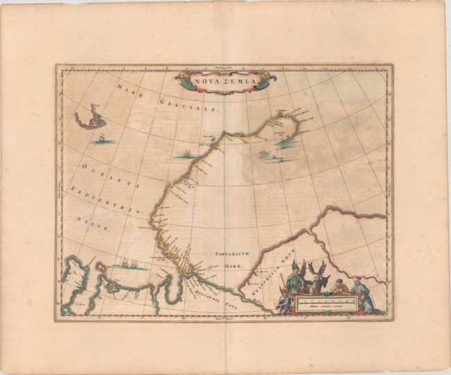
Subject: Novaya Zemlya, Russia
Period: 1672 (circa)
Publication: Atlas Mayor
Color: Hand Color
Size:
19.5 x 15 inches
49.5 x 38.1 cm
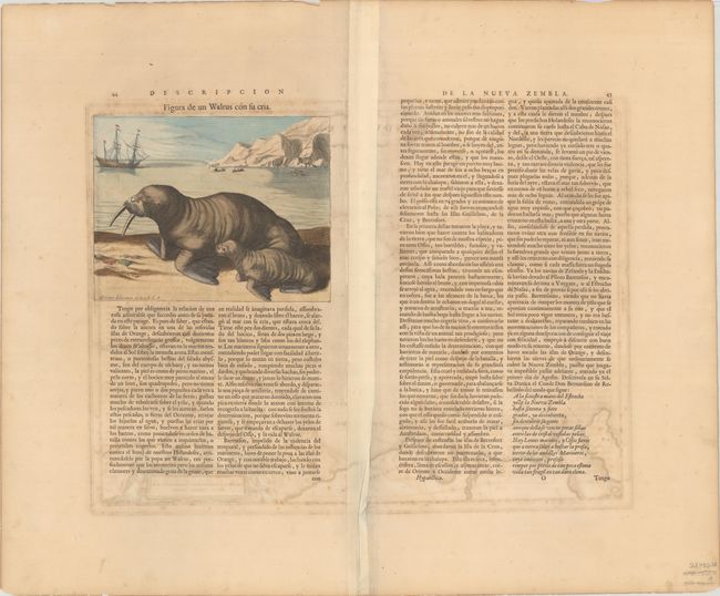
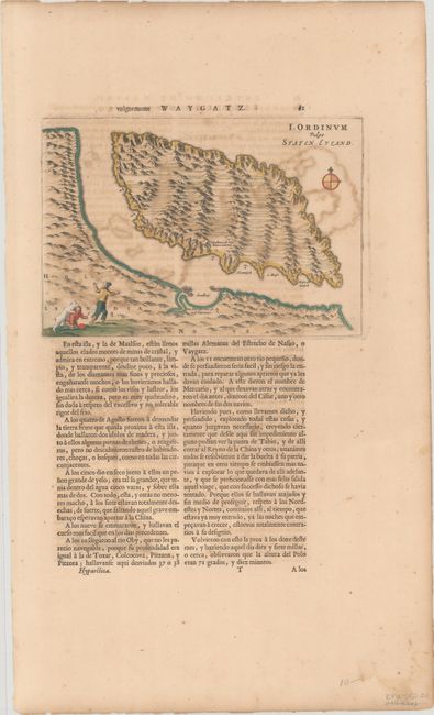
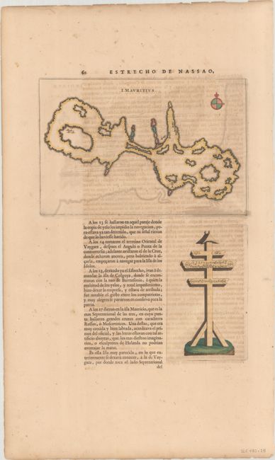
These scarce maps of Novaya Zemlya were only published in the various editions of Blaeu's Atlas Maior. They were drawn from Linschoten and Barents' description of their explorations of the Arctic Sea (1594-97) in search of a Northeast Passage to Asia. The map of Nova Zemla (19.5 x 15") shows the Russian coastline and the western coastline of Novaya Zemlya. Barents' stranded ship and winter camp of 1596 are depicted at the north end of the island. On the verso is a beautiful illustration of walruses (8.6 x 6.8"). The accompanying leaf contains a small map (9.8 x 6.6") of Vaygach Island (Staten Eyland) and the Yugorsky Strait. It is decorated by a small scene of a polar bear attacking two explorers. On the verso is a map (9.7 x 6.5") of Maurits Island, an island that we can’t identify; according to the text, it is near Vaygach. The locations of several crosses with runic characters are noted, along with an illustration of one of the crosses. These are from the Spanish edition published after 1672, the final work of the famous Blaeu publishing house, which was destroyed by fire at the time this edition was being published.
References: Van der Krogt (Vol. II) #1270:2, 1276:2, & 1278:2.
Condition: B
Contemporary color with some gold leaf highlights, with light toning and offsetting. On the <i>Nova Zemla</i> map, there is an archivally repaired centerfold separation at bottom.