Subject: Western Germany
Period: 1639 (circa)
Publication:
Color: Hand Color
Size:
19.3 x 14.9 inches
49 x 37.8 cm
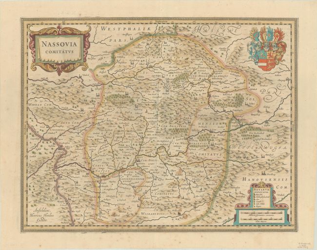
This is a lovely map of the county of Nassau covering the region between Koblenz in the west and Giessen in the east, and between Wiesbaden in the south and Olpe in the north. The Rhine River flows across the southwest corner. The map is richly embellished with decorative title and distance scale cartouches and the coat of arms of Nassau nobility. After Hondius' death in 1629, the plate was acquired by Blaeu who deleted Hondius' name and added his own to the imprint at lower left. French text on verso, published between 1639-49 in either Nouveau Theatre du Monde or Nouvel Atlas.
References: Van der Krogt (Vol. I) #2390.1.1.
Condition: B
A fine impression with contemporary color. There is light scattered foxing and soiling and a 1.5" crack due to oxidation of the green pigment at bottom that has been closed on verso with archival tape.