Catalog Archive
Auction 191, Lot 527

"Superioris Atque Inferioris Alsatiae Tabula Perquam Accurata et Exacta, Proximis Regionib. Incunde Huic Insertis, Annexisque: ex Conatibus", Lotter, Tobias Conrad

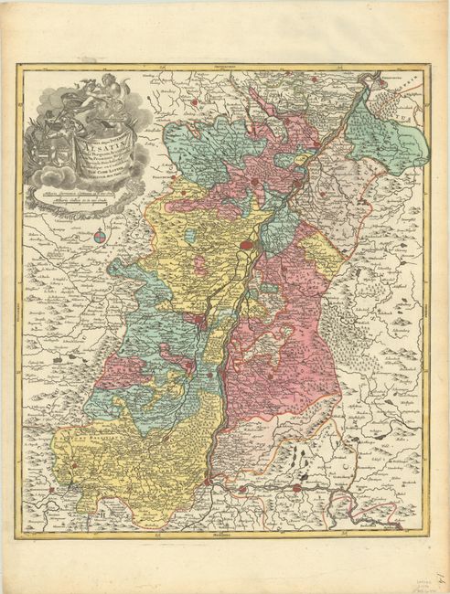
Subject: France & Germany, Rhine River

Period: 1760 (circa)

Publication:

Color: Hand Color

Size:
19.2 x 22.1 inches
48.8 x 56.1 cm
Download High Resolution Image
(or just click on image to launch the Zoom viewer)

This map is centered on Strasburg and follows the Rhine River from Germersheim in the north (just south of Speyer) to Koblenz in Switzerland. The map is densely engraved with towns, rivers, mountains, and forests. The allegorical title cartouche features Mercury and Fame.

References:

Condition: A

A sharp impression with full contemporary color on a bright sheet with slightly rippled paper in the top margin and minor toning along the edges of the sheet.

Estimate: $190 - $220

Sold for: $140

Closed on 2/8/2023

Archived