Catalog Archive
Auction 191, Lot 492

"Carte de la Manche. Faite par Ordre du Roy pour le Service de ses Armees de Mer...", Sanson/Covens & Mortier

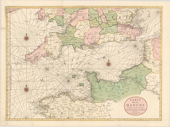
Subject: English Channel

Period: 1740 (circa)

Publication:

Color: Hand Color

Size:
31.4 x 23.1 inches
79.8 x 58.7 cm
Download High Resolution Image
(or just click on image to launch the Zoom viewer)

This boldly engraved double-page chart centers on the English Channel and details southern Britain and northern France. From the north, the map extends from Bedford south to Brittany, and inland to Paris on the Seine and London on the Thames. Just the southern tip of Ireland is included. It includes a compass rose, rhumb lines and other features more typical of a sea chart. A rarely seen map.

References:

Condition: A

A crisp impression with full contemporary color on a bright sheet with a "C&I Honig" watermark, issued folding with archival repairs to a couple of short separations and a 1" tear in Somerset. There is one spot along the coast of Normandy, otherwise very clean.

Estimate: $600 - $750

Sold for: $450

Closed on 2/8/2023

Archived