Subject: England & Wales
Period: 1628-48 (circa)
Publication: Atlas Minor
Color: Black & White
Size:
8 x 5.8 inches
20.3 x 14.7 cm
This handsome trio of maps from various editions of Atlas Minor cover parts of England and Wales. These maps were re-engraved for Jan Jansson's editions of the Atlas Minor, published in 5 editions between 1628-48. The copperplates for the original Atlas Minor editions published by Hondius were sold to parties in England between 1621-25. Jansson commissioned Pieter van den Keere and Abraham Goos to engrave new plates, which were close copies of the original editions.
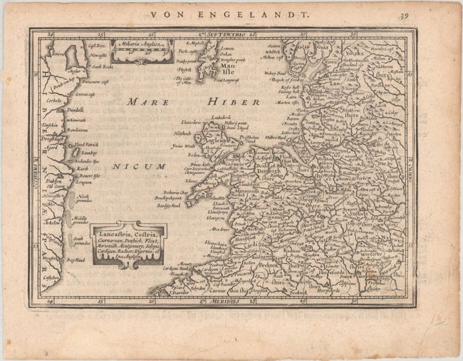
A. Lancastria, Cestria, Caernarvan, Denbich, Flint, Merionidh, Montgomery, Salopia, Cardigan, Radnor, Wigornia, et Ins. Anglesey, circa 1648. Small map of the western part of England and northern Wales including the cities of Lancaster, Stafford, Hereford, Cardigan and Flint. Includes the Isle of Man and a small part of the Irish coastline. Decorated with strapwork title and scale cartouches. German text on verso, from a German edition published between 1648-51. Condition: On a slightly toned sheet with a few light spots and dampstains in the blank margins.
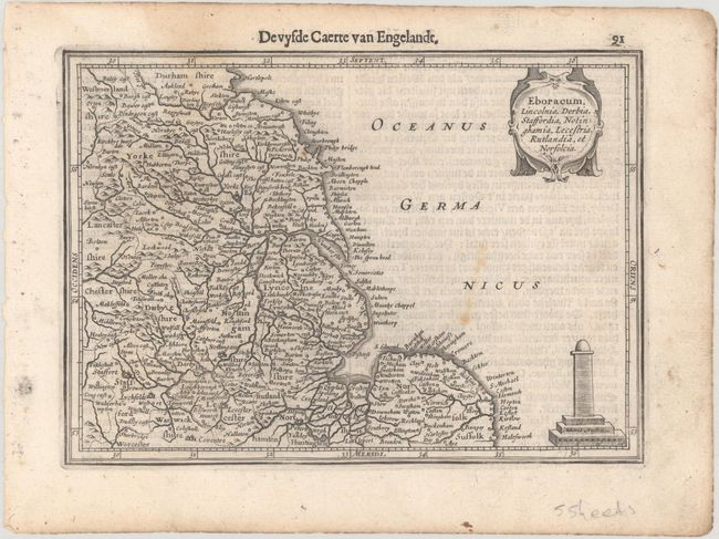
B. Eboracum, Lincolnia, Derbia, Staffordia, Notinghamia, Lecestria, Rutlandia, et Norfolcia, published 1630. Charming map of the eastern part of England including the cities of York, Lincoln, Nottingham, Derby and Norwich. Decorated with a strapwork title cartouche and an unusual monument-style distance scale. Dutch text on verso. Condition: There is a faint dampstain that enters the map image at top left, a few light spots, and light soiling that is primarily confined to the blank margins.
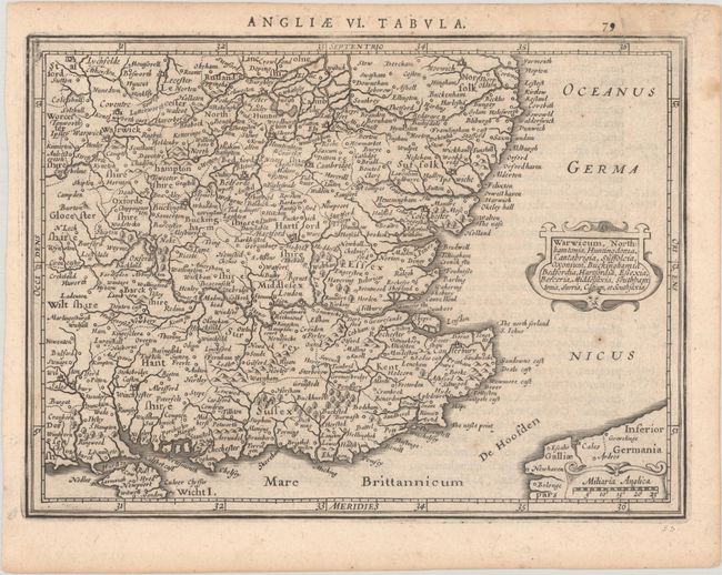
C. Warwicum, Northhamtonia, Huntingdonia, Cantabrigia, Suffolcia, Oxonium, Buckinghamia, Bedfordia, Hartfordia, Essexia, Berceria, Middelsexia, Southhamtonia, Surria, Catium, et Southsexia,published 1628. Appealing map of southeastern England including London, Salisbury, Oxford, Cambridge, Leicester and Norwich and the Isle of Wight. The map is filled with minutely engraved detail and is graced with an attractive title cartouche. Latin text on verso. Condition: A nice impression on slightly toned paper with a few minor spots and a short, archivally repaired tear that just crosses the neatline at top right.
References: Van der Krogt (Vol. III) #5111:352.1; #5113:352.1; & #5114:352.1.
Condition: B+
See description above.